Organize
Component's terminology: Projection had type reference (2,0) (0,2) Physical geographic MODS has longitude coordinate RotationMatrix spacial Coordinates is - Cultural (2,1) system (1,0) name Value altitude latitude Information matrix point (1,1) (2,2) are of (0,0) Cartographics physical Property or coordinates was Scale Cartographic Geometry (1,2) Type geodesic (0,1) Of location minimum Place Altitude altimetric Location
Is narrower than Intentionally act · Agent · Event · Event · Becoming aware - Locating · People · State of entity · Sequence · Relation · Type · Locale · Impute · Using · Locale · Having or lacking access · Intentionally create · Statement · Instance · Communicate categorization · Dimension · Locale · Quantity · Referring by name - Being named · Arranging · Containing - Inclusion · Location of light · Attempt · Cultural · Relation · Project - Purpose · Intentionally create · Biological classification · Aggregate - Organization · Natural features · Locale · Means · Being employed · Awareness · State of entity · Ingredients · Type · Distinctiveness · Communication · Information · Locale · Topic · Scrutiny · Causation - Placing · Acquisition · Locale · Cardinal numbers · Statement ·
Observed Ontology Desing Patterns
Go to the RDF/OWL implementation of the observed ontology pattern
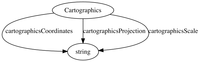
MODS
Terminology of the observed ontology pattern: Cartographics - Scale Projection MODS Cartographic Information Coordinates
Go to the RDF/OWL implementation of the observed ontology pattern
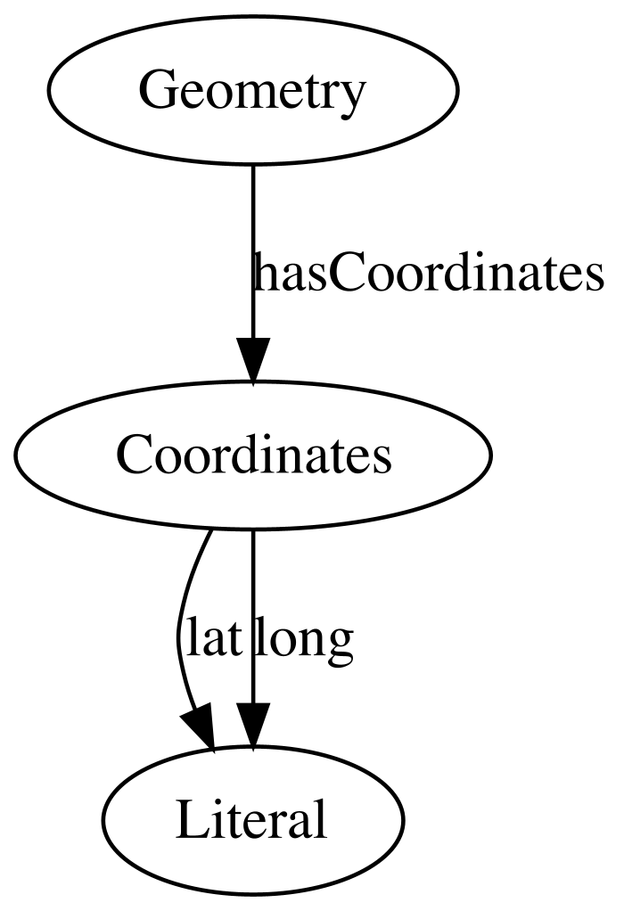
ArCo Ontology (ArCo network)
Terminology of the observed ontology pattern: has coordinates Geometry latitude longitude Coordinates
Go to the RDF/OWL implementation of the observed ontology pattern
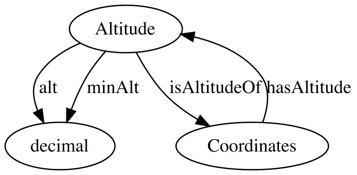
ArCo Ontology (ArCo network)
Terminology of the observed ontology pattern: is altitude of Altitude minimum has Coordinates
Go to the RDF/OWL implementation of the observed ontology pattern
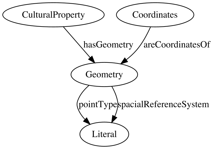
ArCo Ontology (ArCo network)
Terminology of the observed ontology pattern: spacial reference system Geometry Cultural Property point type has are coordinates of Coordinates
Go to the RDF/OWL implementation of the observed ontology pattern
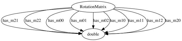
inferred_ARPENTEUR
Terminology of the observed ontology pattern: has (2,2) matrix coordinate (1,1) (0,2) (2,0) (0,0) (1,2) (1,0) (0,1) (2,1) RotationMatrix
Go to the RDF/OWL implementation of the observed ontology pattern
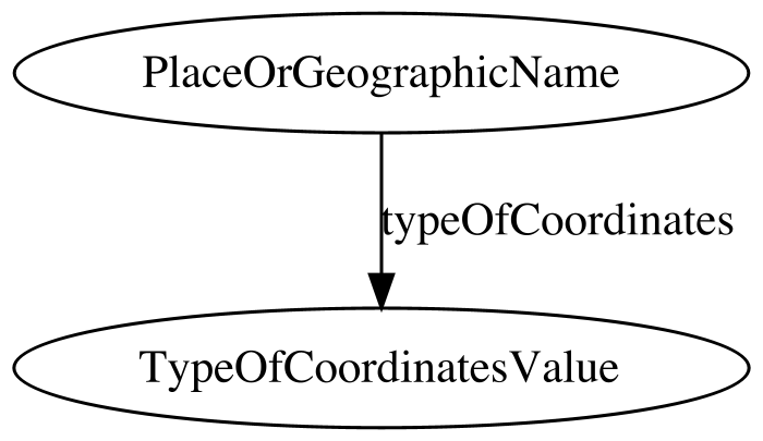
GND Ontology
Terminology of the observed ontology pattern: Place or geographic name Type Of Coordinates Value of coordinates
Go to the RDF/OWL implementation of the observed ontology pattern
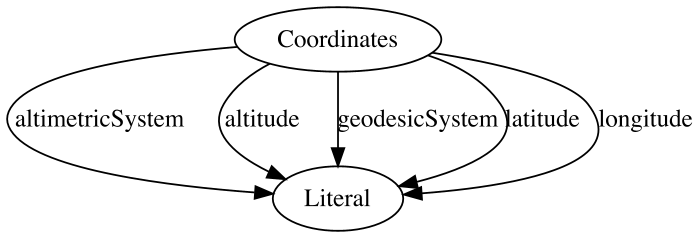
inferred_RiC-O
Terminology of the observed ontology pattern: altitude altimetric system Coordinates latitude geodesic longitude
Go to the RDF/OWL implementation of the observed ontology pattern
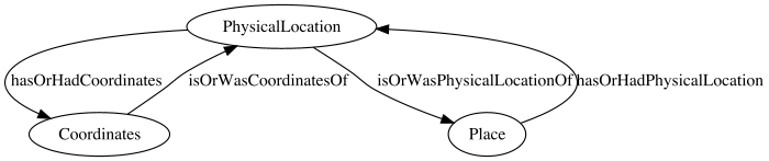
inferred_RiC-O
Terminology of the observed ontology pattern: has or had physical location Physical Location coordinates Coordinates Place is was of